

Along with several other lakes on the slopes of Pikes Peak, the Crystal Reservoir supplies water for the City of Colorado Springs. The Pikes Peak highway crosses over Crystal Reservoir’s dam and past a small gift shop with a large chainsaw sculpture of Sasquatch in the parking lot.
The nineteen mile Pikes Peak Highway was built in 1915, and the first annual hill climb race followed in 1916. A flat valley provided the perfect location for the race cars, crews, and fans of the Pikes Peak Hill Climb. The original starting line was chosen at this flat area, near a little bridge. From this point the race was 12.42 miles to the finish line on the summit of Pikes Peak..
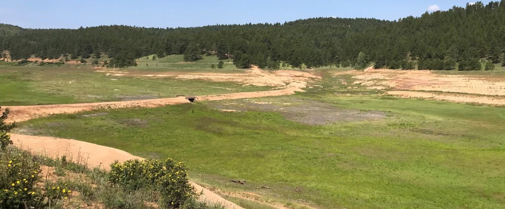
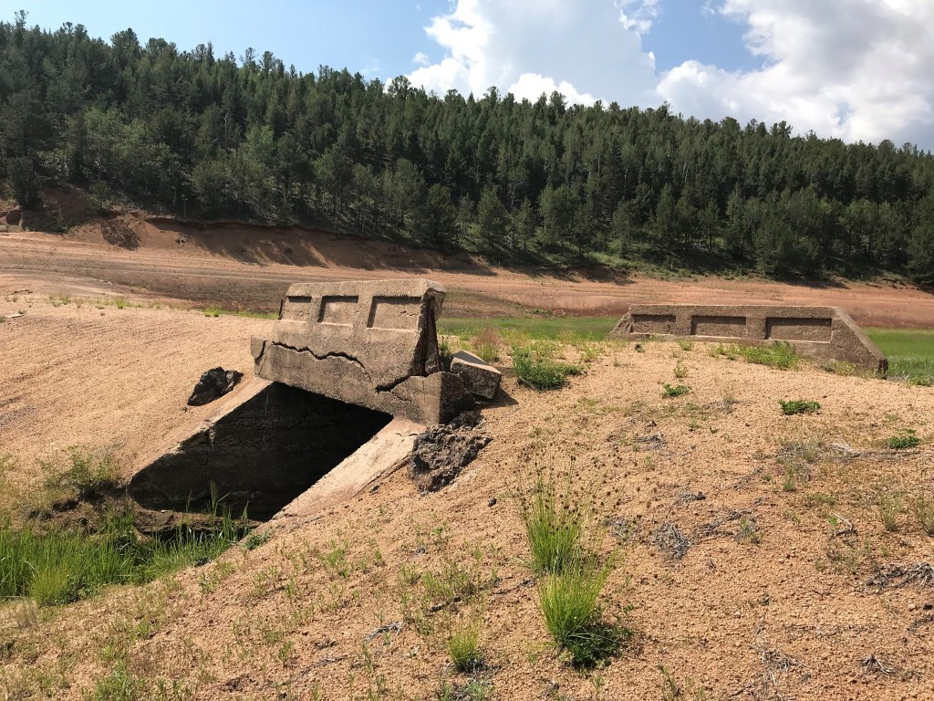
The Pikes Peak highway was rerouted when the reservoir was built in 1935. The section of road that was submerged was a raised causeway through this wide, almost flat, valley. On the causeway was a small concrete bridge over Crystal Creek. When the lake was filled, the causeway and the little bridge were left in place. The new road was rerouted to go around the lake and over the dam, and the little bridge forgotten.
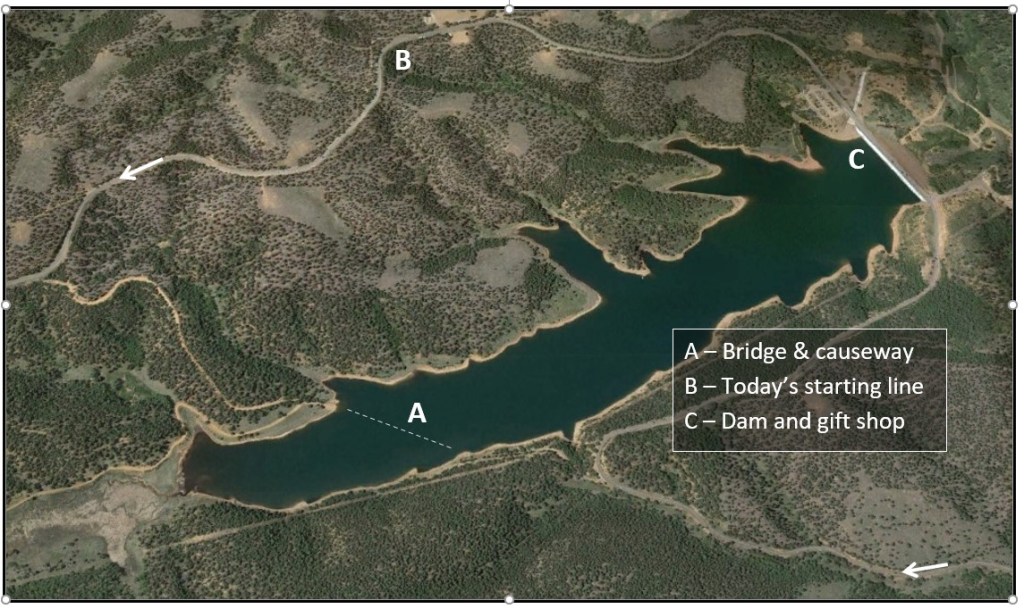
Eric Swab, a local author and historian, tells in his book, “The Granite Attraction – Stories of the Pikes Peak Highway and Summit”, that when the valley was flooded, the first piece of the racecourse was lost. The new starting line was moved the exact same distance down the new road to the current location, so that it would retain precisely 12.42 miles.
It appears that this little lost bridge over Crystal Creek is a big deal after all. Spencer Penrose would have had a hand in the location of the original starting location. The new starting line was determined by the location of the original location at the bridge. This now submerged spot would have been well known as the scene of activity with every race from 1916-1934.
In 2019, and again in 2021, according to the Colorado Springs Utilities Department, Crystal Reservoir was drained so that maintenance on the steel face of the dam could be performed. Interestingly, this is one of only five steel faced dams in the state.
When the lake was drained, the original road across the valley was exposed. The causeway and bridge are in surprisingly good shape when you consider the fact that they have been patiently waiting underwater for 84 years.
Crystal Creek naturally found its way to flow under the little bridge once again, and the newly exposed valley quickly turned lush and green in a panorama not seen for an exceptionally long time.

As of today, 6/27/2022, Google Maps satellite view still shows the bridge!
https://www.google.com/maps/@38.9131735,-105.0354083,182m/data=!3m1!1e3
LikeLike
Thank you, Monte, for pointing that out! The hidden bridge will remain accessible forever! It will be found in the historic imagery when future satellite photos replace it. And it is a good quality photo, too.
LikeLike