

The 1869 transcontinental railroad was the only way to get from coast to coast without a wagon and horse. It took 43 years before the idea to connect rural roads into one long coast-to-coast route came to be. Cities, counties and states collaborated to connect their dirt roads and no federal origination or funds were involved.
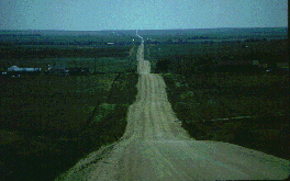
The Lincoln Highway was the first road to connect the nation from coast to coast, completed in 1912. Of course the definition of “highway” was much different than it is today, as the road from coast to coast was gravel at best, and muddy ruts at its worst. You may have passed the huge bust of Abraham Lincoln on Interstate 80 west of Cheyenne, Wyoming that celebrates this historic route.
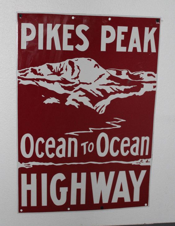
Colorado wanted to get in on the new automobile tourists traveling the Lincoln Highway because it had ignored the entire state of Colorado by rudely running through Wyoming. Other states outside of the original route felt the same, so two years later, the new 1914 route through Colorado offered direct competition with the 1912 road. Just like the Lincoln Highway, the Pikes Peak Ocean to Ocean Highway was pieced together to connect the east and west coast from New York to San Francisco. Technically, it also ran the other direction from Los Angeles to New York, but in this exciting time of westward expansion, who would want to do that? West to east was not promoted.
The Ocean to Ocean Highway had Pikes Peak in the name to show how much better this muddy route was over the other muddy route. Signs were placed at towns and intersections all across the United States from New York City to San Francisco, California.

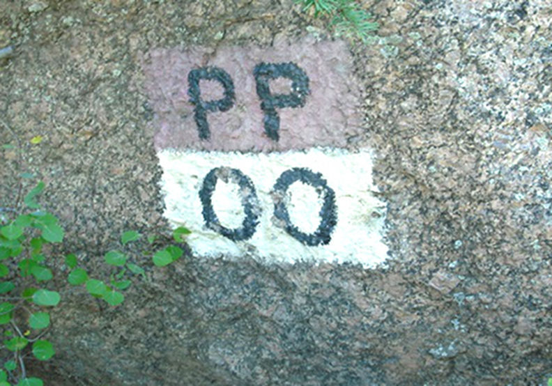
A “PP-OO” signpost meant that you were on the right track; the message was sometimes on poles and often painted on large rocks. Promotions and bragging rights by the towns along the way were similar to that of the Route 66 phenomenon that would come decades later.
Other parts of Colorado wanted in on the tourist action, so a second route was created. The western terminus later changed from San Francisco to Los Angeles. The nickname, “the highway that can’t make up its mind,” was given to the PPOO Highway by the early 1920’s.
In 1926, Highway 50 took over as the popular coast-to-coast route. The following year, Route 66 got all the glory, running from Chicago to LA. The PPOO Highway was later given the numerical designation as Highway 24 through Colorado.

Colorado Springs Connection
The national headquarters for this New York to San Francisco highway was in the Burns Building, above the Chief Theater. The highway came in on Platte Avenue, took a jog left on Nevada and then a right turn onto Colorado Avenue. This took the highway up Ute Pass. Can you imagine the thrill of starting up the Rocky Mountains after going through Missouri and Kansas? Colorado City and Manitou Springs capitalized as a staging point with cafes and motels and the thrill worked both ways. Colorado residents heard the stories from these adventuresome transcontinental travelers.
A Famous Intersection
Atlantic-to-Pacific crosses Canada-to-Mexico In the 1920’s, the CanAm highway was built to connect Canada to Mexico and the CanAm Highway name still shows up on modern maps. Later given the designation of Highway 85, this highway runs through Colorado Springs as Nevada Avenue. With all this information, can you imagine where the PPOO and the CanAm intersected?
Did you figure out that the General Palmer statue now stands guard over this once notable intersection?

For more information on the Pikes Peak Ocean to Ocean Highway, visit ppoo.org
If you wish to explore a bit of the route, see our chapter “Bike a Section of the PPOO”
This is an excerpt from the book “Easy Hikes to the Hidden Past” Pikes Peak Region Edition.

